Search

Leave a Message

Thank you for your message. I will be in touch with you shortly.

Explore My Properties

Manalapan Dockage and Ocean Access Boating Guide

December 18, 2025

If you want to take your boat from your backyard to the Atlantic quickly and safely, the details matter. In Manalapan, the right dock, bridge clearances, and inlet proximity can make daily boating a joy or a frustration. You deserve clear, candid guidance so you can match the property to your vessel and lifestyle. This guide walks you through dockage, ICW routes, bridges, and ocean access so your next home works for how you actually boat. Let’s dive in.

Manalapan boating at a glance

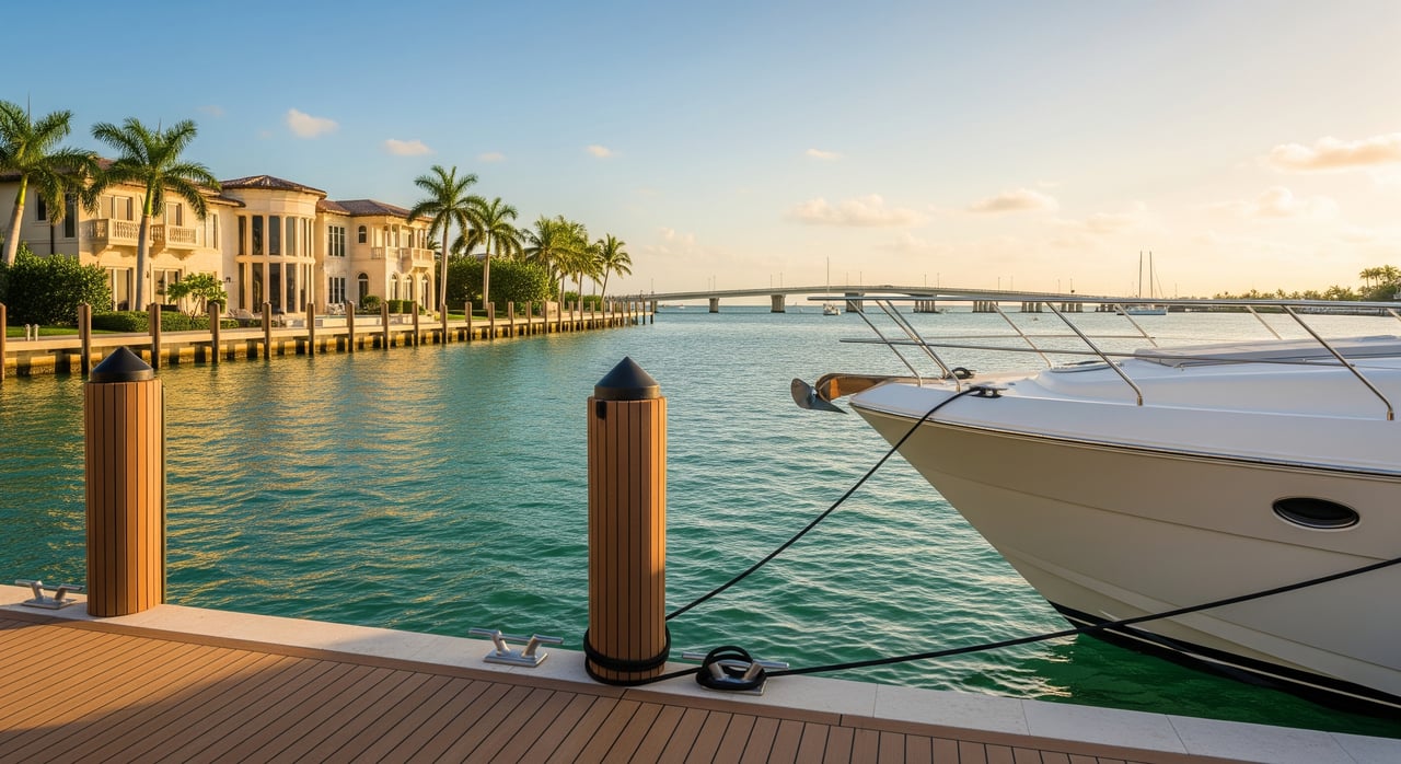
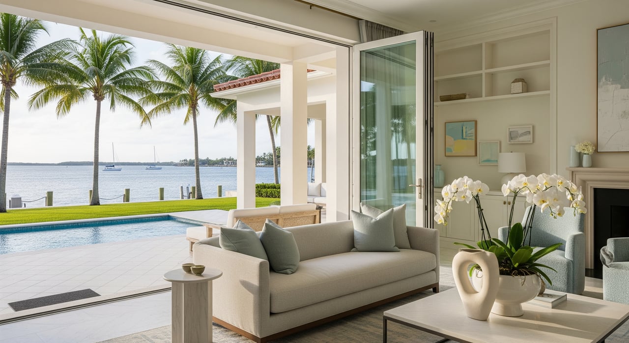
Manalapan sits along the Atlantic barrier island in Palm Beach County, where many owners run powerboats, express cruisers, and sportfishing boats. You use the Intracoastal Waterway for protected cruising and services, then head to the ocean through a nearby inlet. Your best-fit property depends on your boat and plans, whether you want frequent offshore trips or relaxed local cruising.

Dockage basics in Manalapan

Private waterfront homes often feature concrete seawalls with fixed docks and pilings. Floating docks are less common for larger yachts and show up more for smaller craft and personal watercraft. If private deep-water dockage is not ideal for your vessel, you can explore nearby marinas or private mooring options.

What to measure at the dock

Before you buy, confirm the dock can safely and comfortably handle your boat:

  • Water depth at mean low water at the dock face
  • Usable dock length, beam limits, and turning basin space
  • Piling condition, dock hardware, fendering, and shore power
  • Lift presence and capacity if you plan to store on a lift
  • Bottom type, which impacts anchoring and the risk of shoaling

Depth and maneuvering room are the day-to-day constraints you will feel most. Even a foot of difference at low tide can affect your ability to dock or depart.

Permits, upgrades, and rules

Dock, seawall, and lift work typically requires county or state permits. Always check prior permit history to understand what exists and what you can replace or upgrade. Review riparian rights in title and plat documents, and ask about HOA or village rules that may limit dock type or guest docking.

  • For permit records and shoreline programs, check Palm Beach County Environmental Resources Management for guidance and history.
  • For state marine regulations and permitting guidance, review the Florida Department of Environmental Protection and the Florida Fish and Wildlife Conservation Commission.

Helpful resources:

  • Review NOAA nautical charts for depths, channels, and aids to navigation for any property you are considering.
  • Check FEMA Flood Insurance Rate Maps to understand flood zones and elevation considerations.

Bridges and ICW navigation

The ICW connects you to marinas, fuel, dining, and other coastal towns in a protected corridor. Your route may pass under fixed bridges or require openings at movable bridges.

Fixed vs. movable bridges

  • Fixed bridges have a single vertical clearance number. Your boat’s air draft must clear at typical water levels.
  • Movable bridges operate on set schedules or on request for taller vessels. Rules and timing can change, so confirm the latest operating details before you rely on them.

Confirm air draft before you buy

If your boat has a tower, hardtop, or outriggers, bridge clearance can be the make-or-break factor. Build a route checklist from the property dock and list every bridge with its vertical clearance at low tide and the opening schedule. Always verify current values and operations through the U.S. Coast Guard Local Notice to Mariners and NOAA chart updates.

Helpful resources:

  • Check Local Notices to Mariners for bridge operations and temporary changes.
  • Use NOAA charts and updates for route planning and soundings.

Inlet and ocean access

Inlets are the gateways to the Atlantic. Being closer to an inlet reduces transit time offshore, which is valuable if you fish, dive, or cruise oceanfront frequently. Proximity can also mean more exposure to open-water motion and storm surge, which you should factor into design and insurance.

Tides, shoaling, and safety

Inlet approaches can shift due to storms and currents. Shoaling, bars, and strong tidal flow change quickly, so local knowledge and current charts are essential. Many boaters time inlet transits near mid to high tide and choose daylight when conditions are challenging. The U.S. Army Corps of Engineers and local authorities publish dredging and navigation advisories, so check for recent work or recurring hotspots before you run.

Helpful resources:

  • Review U.S. Army Corps of Engineers Jacksonville District updates for channel projects and dredging.
  • Confirm any inlet advisories in the U.S. Coast Guard Local Notice to Mariners.

Hurricane and insurance planning

Oceanfront and inlet-proximate homes face higher exposure to surge and wave energy during storm season. Dock and lift design should meet local wind and wave standards, with pilings set for expected loads. Insurers often require proof of structural soundness and compliant electrical work at the dock, and waterfront flood zones can increase premiums.

Use FEMA maps to confirm flood zones, and budget for upgrades like taller pilings, hurricane-rated lifts, and improved fendering. These investments protect your vessel and your dock during seasonal weather.

How access affects value

Waterfront value ties closely to how a property supports the way you boat:

  • Deep-water dockage that accommodates larger yachts often commands a premium, especially close to inlet access.
  • ICW or canal-front homes with limited depth or multiple bridge constraints usually suit smaller cruisers and center consoles and are typically priced accordingly.
  • Maintenance and upgrade costs for docks, lifts, and seawalls should be part of your offer strategy. Permit clarity and recent structural work can strengthen value and reduce risk.

Buyer due-diligence checklist

Use this step-by-step approach to ensure the property fits your vessel and routes:

  1. Depth and berthing
    • Verify water depth at mean low water and turning space with current NOAA charts and a recent survey.
    • Measure usable dock length, beam limits, and confirm piling condition and fendering.
  2. Lifts and utilities
    • Confirm lift capacity versus your boat’s loaded weight and beam.
    • Inspect shore power, lighting, and GFCI protection for compliance.
  3. Permits and rights
    • Pull permit history through Palm Beach County ERM and confirm riparian rights, easements, and any HOA or municipal rules.
  4. Route audit
    • From the dock to your preferred destinations, list bridges, vertical clearances at low tide, and movable-bridge schedules.
    • Cross-check with the U.S. Coast Guard Local Notice to Mariners and NOAA charts for current data.
  5. Inlet conditions
    • Review U.S. Army Corps and USCG notices for dredging, shoaling advisories, or temporary restrictions near your nearest inlet.
  6. Insurance and flood risk
    • Confirm your flood zone with FEMA maps and request quotes that include dock, lift, and seawall coverage.
  7. Professional support
    • Engage a marine surveyor for the dock and pilings, a local captain for route testing, and a marine contractor for cost estimates on repairs or upgrades.

Local resources

Ready for candid, local guidance?

If you are weighing two great homes but only one fits your vessel and routes, that is where experience saves you time and stress. You get white-glove, advisory support that aligns construction realities, permitting, and day-to-day boating use so you can buy with confidence. For a private consultation and access to curated coastal opportunities, connect with John R Hackett.

FAQs

What should I measure at a Manalapan dock before I buy?

  • Confirm mean low water depth, usable dock length, turning basin space, piling condition, and lift capacity relative to your boat’s loaded weight and beam.

How do local bridges affect my boat choice?

  • Your boat’s air draft must clear fixed bridges, or you need movable bridge openings; build a route checklist and verify current clearances and schedules through USCG notices and NOAA charts.

How do I estimate transit time to the ocean from a property?

  • Identify the nearest inlet on NOAA charts, note distance and no-wake zones on the ICW, and factor your typical cruise speed and any bridge opening waits into the estimate.

What permits are required to replace a dock or seawall in Palm Beach County?

  • Most work requires county and state approvals; start with Palm Beach County ERM for records and process, and confirm state requirements with Florida DEP.

How do tides and shoaling impact inlet safety near Manalapan?

  • Conditions change with storms and currents; many boaters time runs near mid to high tide and always check U.S. Army Corps updates and the USCG Local Notice to Mariners before transiting.

How does hurricane risk affect insurance for waterfront homes?

  • Flood zones and exposure can increase premiums; confirm your FEMA flood zone, have a marine surveyor evaluate the dock and lift, and budget for hurricane-rated upgrades to reduce risk.

Let’s Find Your Dream Home

Well-respected in his field and in the community, John’s success in real estate can be attributed to his long-time affinity for architecture, development, and construction. While enjoying the quintessential coastal lifestyle, John prioritizes spending time with his family, enjoying a round of golf with friends, and contemplating pathways to success for himself and those around him.